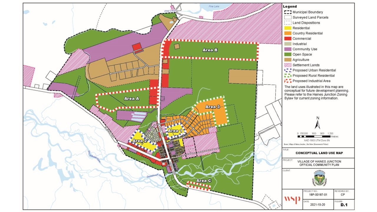
 The Conceptual Land Use Map was produced through the Haines Junction's Official Community Planning process. View the Zoning Bylaw in full here: Haines Junction Zoning Bylaw 1996 (last amended in January 2022)
Zoning Bylaw
Why do we have a Zoning Bylaw?
The purpose of the Zoning Bylaw is to implement the development control provisions of the Official Community Plan of the Village of Haines Junction, and for that purpose, among others:
- to divide the Village into zones;
- to prescribe and regulate for each zone the purpose for which buildings and land may be used;
- to prohibit the use of such land or buildings for any other purposes; and
- to prescribe and regulate standards for outdoor commercial advertising, and off-street parking in the interests of the amenity and safety of the Village’s residents.
View the Zoning Bylaw here: Consolidated Zoning Bylaw as of January 26, 2022
Download the Conceptual Land Use Map here: Zoning Bylaw Map
Updating the Zoning Bylaw
The Village has been working to update the Zoning Bylaw since the Official Community Plan was adopted in 2021.
View the latest draft based on public consultation in the spring of 2024: Draft Updated Zoning Bylaw
If you have any questions pertaining to the Conceptual Land Use Map or the Zoning Bylaw, or wish to provide comments on the Draft Updated Zoning Bylaw, please contact the Village Office at admin@hainesjunction.ca or call 867 634-7100.